Larke Pass — officially Larkya La — sits at 5,160 meters and is the defining challenge of the Manaslu Circuit Trek. The crossing day covers roughly 18 kilometers, making it not only the highest point on the circuit but also the longest single stage. Proper preparation, an early start, and good judgment about weather are what separate a successful crossing from a dangerous retreat.
The Lead-Up: Dharamsala Base Camp
Most trekkers arrive at Dharamsala (4,460m) the day before the pass crossing. This stone shelter settlement is sparse — a few basic teahouses with limited menu options. There is little to do at Dharamsala except rest, hydrate, and sleep as early as possible.
The elevation at Dharamsala already puts you well above what most people sleep at in normal life. Even if you feel fine, your body is working harder. Eat a warm meal, avoid alcohol, and resist the temptation to explore far from camp.
Pre-crossing checklist:
- Headlamp with fresh batteries (you will leave in darkness)
- Trekking poles (essential on the descent)
- Warm layers including down jacket, gloves, and balaclava
- Water with electrolytes — at least 2 liters
- High-calorie snacks accessible without removing your pack
- Sunscreen and glacier glasses (UV intensity at altitude is severe)
Departure Time and Why It Matters
Most guided groups leave Dharamsala between 3:00 and 5:00 AM. This timing is deliberate. The snow on the pass is firmer in the early morning hours, making footing more reliable. Afternoon weather deterioration — including wind, cloud, and occasional snow squalls — is common above 4,500m. Crossing the pass by midday or early afternoon gives you a significant safety margin.
Late starters face softer snow, reduced visibility risk, and more fatigued trail companions. Your guide will set the departure time — trust that judgment.
The Ascent: Dharamsala to Larke Pass (4,460m to 5,160m)
The climb from Dharamsala to the pass gains 700 meters over approximately 5–6 kilometers of glaciated terrain. The trail passes along the edge of a glacier, crossing moraine fields and rocky slopes. Cairns mark the route, but in poor visibility or fresh snow, they can be difficult to follow — another reason a mandatory guide is genuinely valuable here.
Key features of the ascent:
- The glacier traverse: A section of the route crosses alongside (and occasionally over) glacial ice. Ice axes are not typically required in normal conditions, but crampons may be warranted after heavy snowfall.
- The false summit ridge: Before the true pass, the trail rises over a ridge that many trekkers mistake for the top. Conserve energy.
- Prayer flags at the top: The summit of Larke Pass is marked with stacked cairns and colorful prayer flags. On a clear day, the views of Manaslu, Himlung Himal, Cheo Himal, and Annapurna II are extraordinary.
Conditions at the Top
At 5,160m in the early morning, temperatures often sit between -10°C and -20°C. Wind is almost always present. Stop only long enough for photos and a brief rest — your body is working hard to maintain temperature at this altitude and sustained standing still will chill you quickly.
The air has roughly half the oxygen pressure of sea level. Most trekkers report feeling breathless, mildly headachy, and mentally slower than normal. These are expected responses. If someone in your group is showing signs of serious altitude sickness — confusion, severe ataxia, coughing up pink froth — descend immediately.
The Descent: Larke Pass to Bimtang (5,160m to 3,590m)
The descent covers approximately 1,570 meters over 7–8 kilometers of trail. This is often described as the most physically demanding part of the crossing — not because of altitude, but because of the terrain and leg fatigue.
Phase 1: Upper Moraine (5,160m to ~4,500m)
The initial descent from the pass is steep and crosses loose glacial moraine. This is where trekking poles earn their keep. The footing is unstable — a mix of rock, gravel, and compacted snow — and the consequences of a slip are serious on the steeper sections. Take your time.
Phase 2: Trail Consolidation (~4,500m to 4,000m)
The trail becomes more defined as you descend below the moraine zone. Views open up across the Dudh Khola valley toward Bimtang.
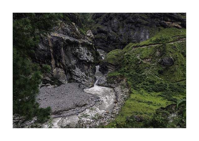
Phase 3: Valley Floor to Bimtang (4,000m to 3,590m)
The final approach to Bimtang crosses a wide, flat glacial valley. By this point most trekkers are tired but relieved. Bimtang is a beautiful meadow settlement — surrounded by peaks, with teahouses that feel genuinely welcoming after the long day.
Timing Summary
| Segment | Distance | Time Estimate | |---|---|---| | Dharamsala → Larke Pass | ~5–6 km | 4–5 hours | | Larke Pass → Bimtang | ~7–8 km | 3–4 hours | | Total Crossing Day | ~18 km | 7–9 hours |
When to Turn Back
Turnaround conditions include: fresh heavy snowfall that has obscured the trail, cloud ceiling below 4,800m with limited visibility, sustained winds above 60 km/h, and any member of the group showing severe AMS symptoms. A good guide will make this call without hesitation. The pass will be there next time — the priority is always safe return.